I was telling KLS the other day, on one of our near-daily walks, all about the paper-delivery job my brother, father and I used to do back when I was a youngling. The newspaper was the local free paper, The Star, and we used to deliver it to a section of the town of Redhead, near where we lived in those days.
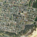
I described my memories of the job – which were quite vivid – and found myself thinking all about Redhead, and wondering how those 20 or 30 blocks we used to deliver to are these days. When we got home I fired up Google Earth, and had a look:
There it is, the part of Redhead we used to deliver to. But…, but it’s not quite the same. It has, of course, changed. This (beautiful, very high-res) image is the Redhead of now. What I want to see is the Redhead of 1985-6.
This got me thinking about the potential of Google Earth. We fire up the software now and see astounding images of Earth from above. The quality is ever-increasing and more and more of the planet is being mapped. Take this next shot as an example of how pristine the images can be:
Those are surfers at Merewether Beach, which is a beach close to where my parents live. This image was captured (by a low-flying plane) in December 2006, and as you can see it is impressively detailed, and exists as a nice snapshot of a day at the beach for a bunch of surfies. In time, this image will be replaced. Perhaps the next image will be taken in winter, and the water may be rougher and few (if any) surfers would be present. Years down the line the shape of the beach itself may change. A hundred years hence there may not even be a beach at all.
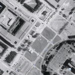
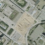
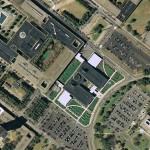
Future generations will be able to see all this at a glance, for Google Earth has a nifty ‘view historical information’ option. Select a date and watch the image change before your eyes. As an example, check out these three shots of the building in which I spend most of my time when I am at school, the Life Sciences building:
Above, we have the same place over a 13 year period. The earliest image in Google Earth is from 1994, and shows the spot where the building is today to be just a grassy field. In 2001 – when I started school at UAlbany, the building had begun construction. And by 2007 – the most recent imagery – you can see the building is complete.
This building is trivial stuff, except perhaps to future historians of Albany or UAlbany. Imagine however the full potential of Google Earth as a chronicle of human history. Imagine were we able to fire up Google Earth, dial in 1944, and examine in great detail the front lines in Europe, or the wreckage in the wake of the explosions in Japan? Imagine were we able to dial up 1000AD and check out the middle ages, or 2000AD and see New York City with a world trade center. Who’s to say which images, right now, may be of priceless importance in the years to come?
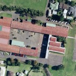
On a more personal note, I’d love to be able to check out such things as my old schools and see them as I remember them, and not as they are now. St Mary’s for instance… time has moved on:
There is no imagery for Australia prior to 2004, and as much fun as it is to ‘virtually travel’ using the current maps… how much fun would it be to go back in time and see the haunts of my youth as they were in those days? Future generations will be doing just this, and I’m sure old man Robert will be doing the same, reminiscing about this period of my life.
But to have all the years of your life saved in the Google Earth database! What I wouldn’t give for such a vivid history book!

Last time I was in Australia I drove past all the old houses we lived in to show Lakshmi. We also drove around Redhead and went to the beach. We can do it again.